• Skip to navigation (Press Enter)
  • Skip to main content (Press Enter)

INOGO

A PROGRAM OF THE STANFORD WOODS INSTITUTE for THE ENVIRONMENT

  • Contact
  • Get Involved
  • EspaƱol
  • English
  • Facebook
  • Youtube
  • About
    • Project Overview
    • People
    • Partners
    • Newsletter Archive
  • Programs
    • Leadership Program (Caminos de Liderazgo)
    • Monitoring & Evaluation
    • Palm
    • SELAL
    • DynaMar
  • News & Events
    • News & Events
    • Local Events
    • Stanford Events
  • Resources
    • Case Studies
    • Diagnostic Analyses
    • Scenarios
    • INOGO Mapas
  • Libraries
    • Reference Library
    • Map Library
    • Video Library
Share

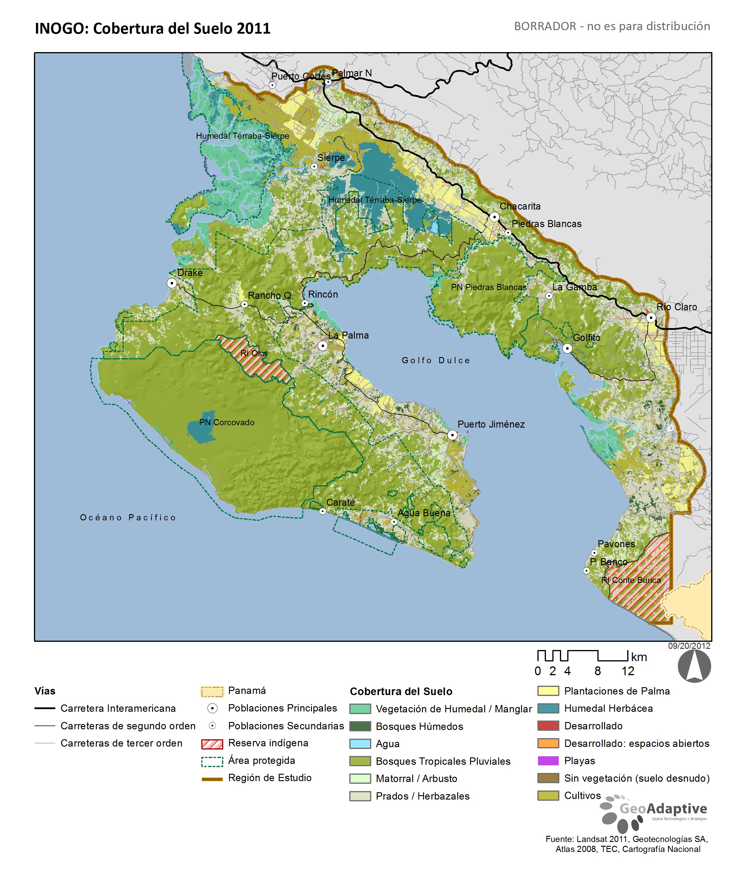
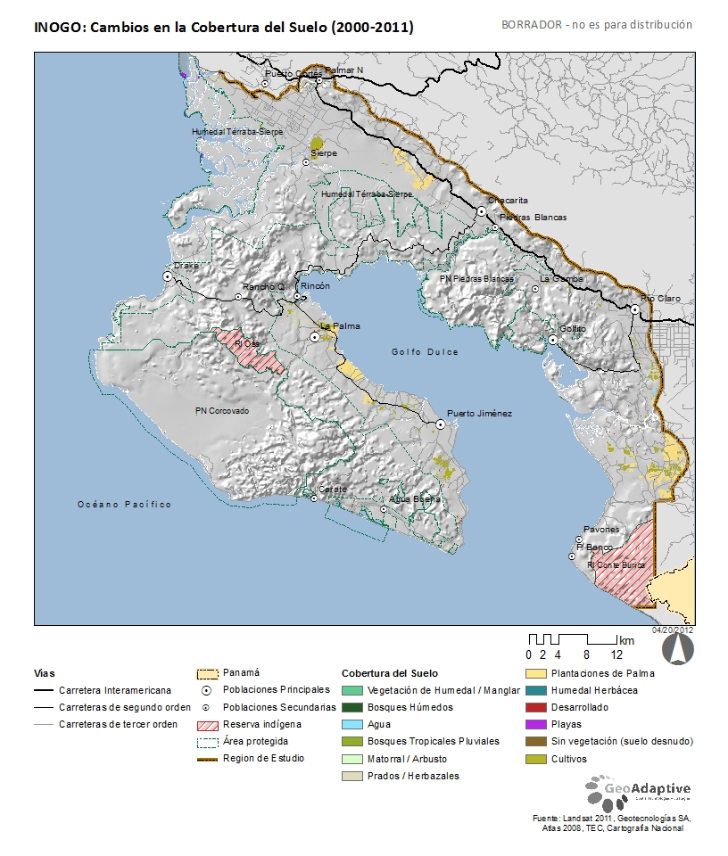
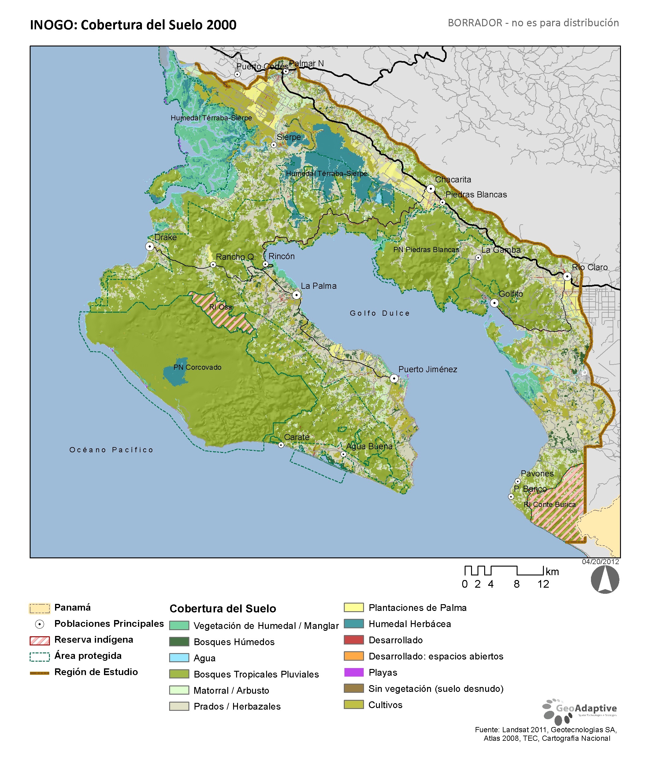
Land Use Land Cover Change (LULC) Maps

Publication Date: 
August 23, 2013
Team Members: 
Dr. Juan Carlos Vargas-Moreno

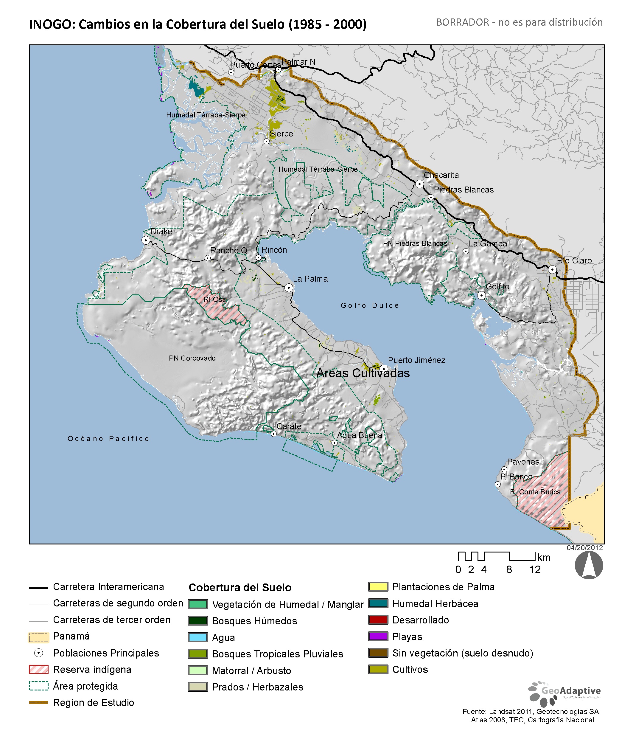
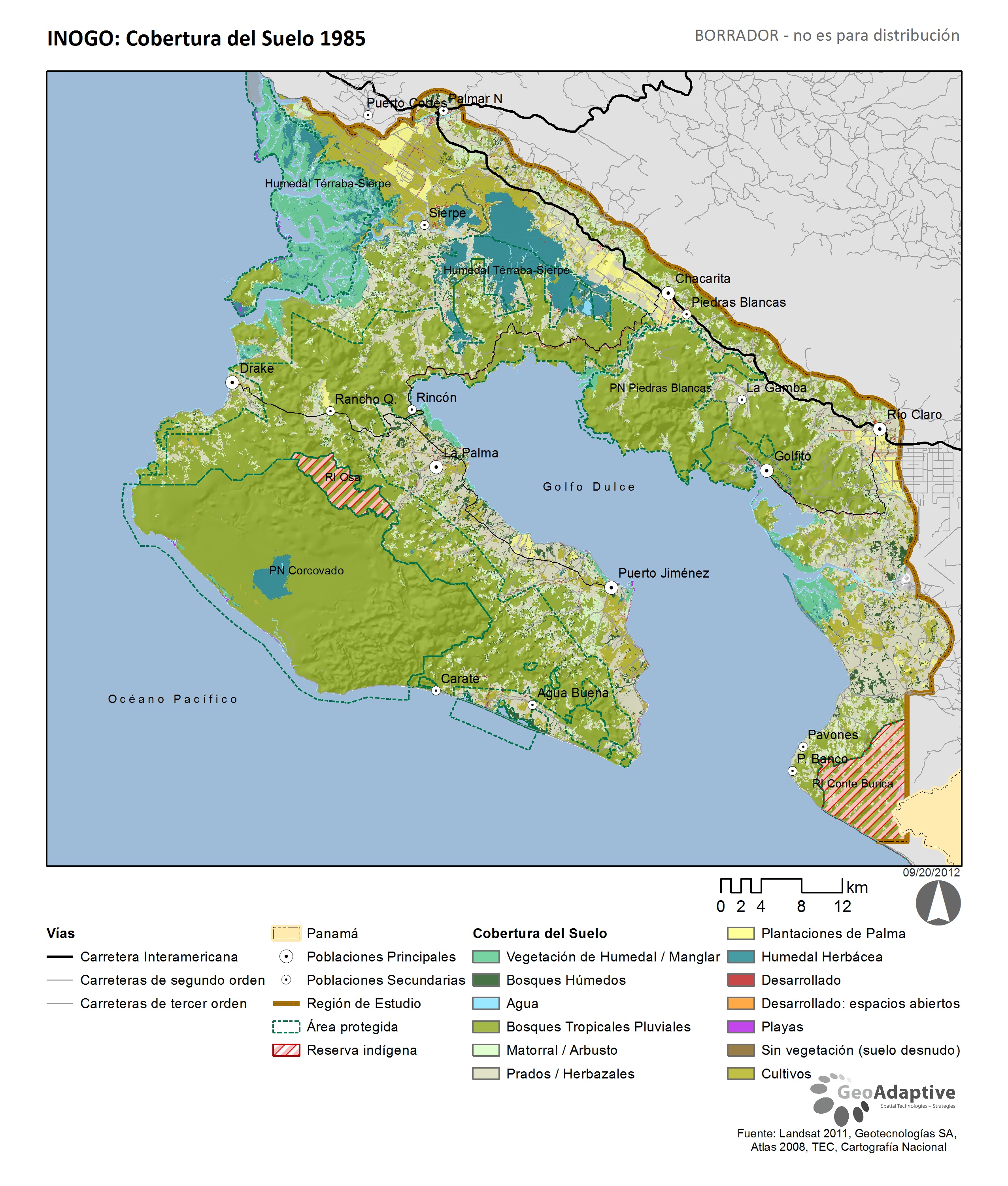
Below please find maps created by GeoAdaptive to demonstrate how land use has changed in the Osa and Golfito region from 1985-2011.

Related Documents

  • Image icon LCLU_2011.jpg (JPG/1,728.07 KB)
  • Image icon INOGO_LULC_00_to_11.jpg (JPG/476.28 KB)
  • Image icon LULC_2000.jpg (JPG/1,215.32 KB)
  • Image icon LULC_85_to_00.jpg (JPG/1,113.18 KB)
  • Image icon LULC_1985.jpg (JPG/1,731.40 KB)
Stanford

© Stanford University

  • Terms of Use
  • Privacy Policy
Stanford Woods Institute for the Environment