• Skip to navigation (Press Enter)
  • Skip to main content (Press Enter)

INOGO

A PROGRAM OF THE STANFORD WOODS INSTITUTE for THE ENVIRONMENT

  • Contact
  • Get Involved
  • Español
  • English
  • Facebook
  • Youtube
  • About
    • Project Overview
    • People
    • Partners
    • Newsletter Archive
  • Programs
    • Leadership Program (Caminos de Liderazgo)
    • Monitoring & Evaluation
    • Palm
    • SELAL
    • DynaMar
  • News & Events
    • News & Events
    • Local Events
    • Stanford Events
  • Resources
    • Case Studies
    • Diagnostic Analyses
    • Scenarios
    • INOGO Mapas
  • Libraries
    • Reference Library
    • Map Library
    • Video Library
Share

Human Use Maps

Publication Date: 
August 23, 2013
Team Members: 
Dr. Juan Carlos Vargas-Moreno

Maps, created by GeoAdaptive, that show the current and potential types of human use in the Osa-Golfito region.

Related Documents

  • Image icon 
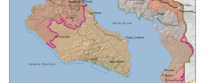
INOGO_L°mites_v2.jpg (JPG/461.31 KB)
  • Image icon 
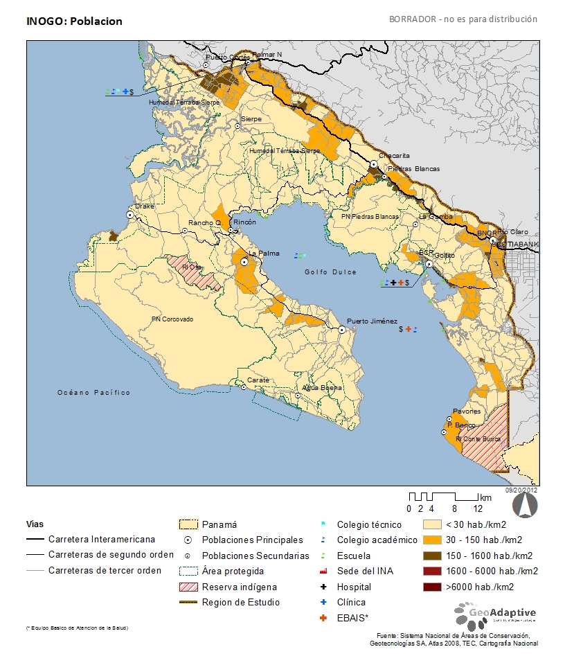
INOGO_Poblacion.jpg (JPG/487.12 KB)
  • Image icon 
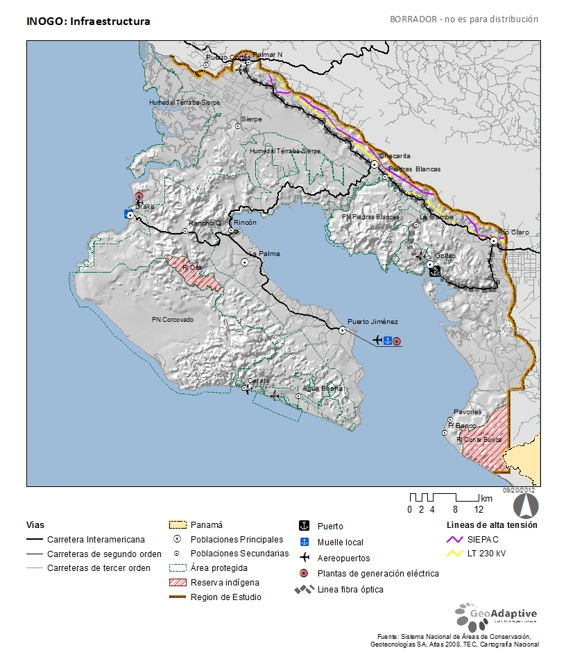
INOGO_Infraestructura.jpg (JPG/452.11 KB)
  • Image icon 
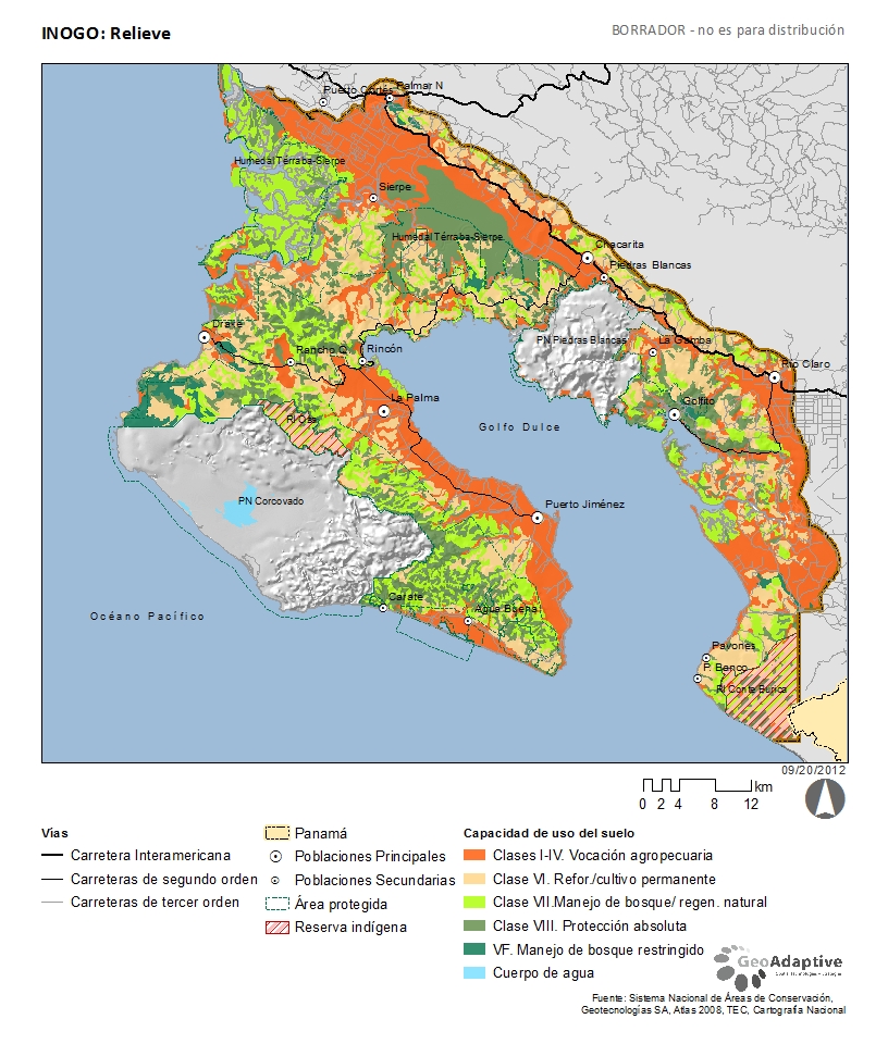
INOGO_fs_CapUso.jpg (JPG/510.65 KB)
  • Image icon 
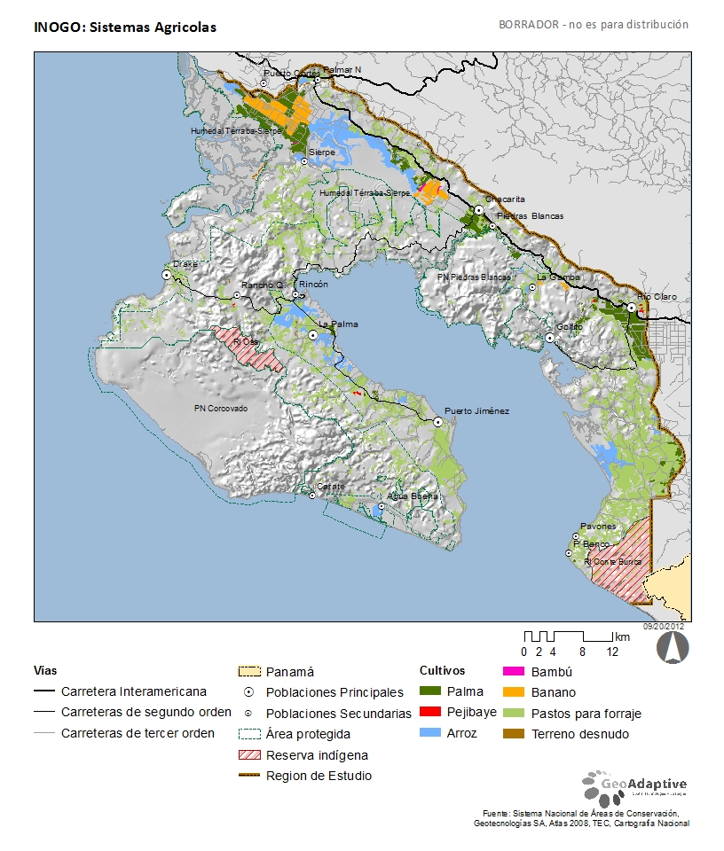
INOGO_Agricultura.jpg (JPG/477.21 KB)
  • Image icon 
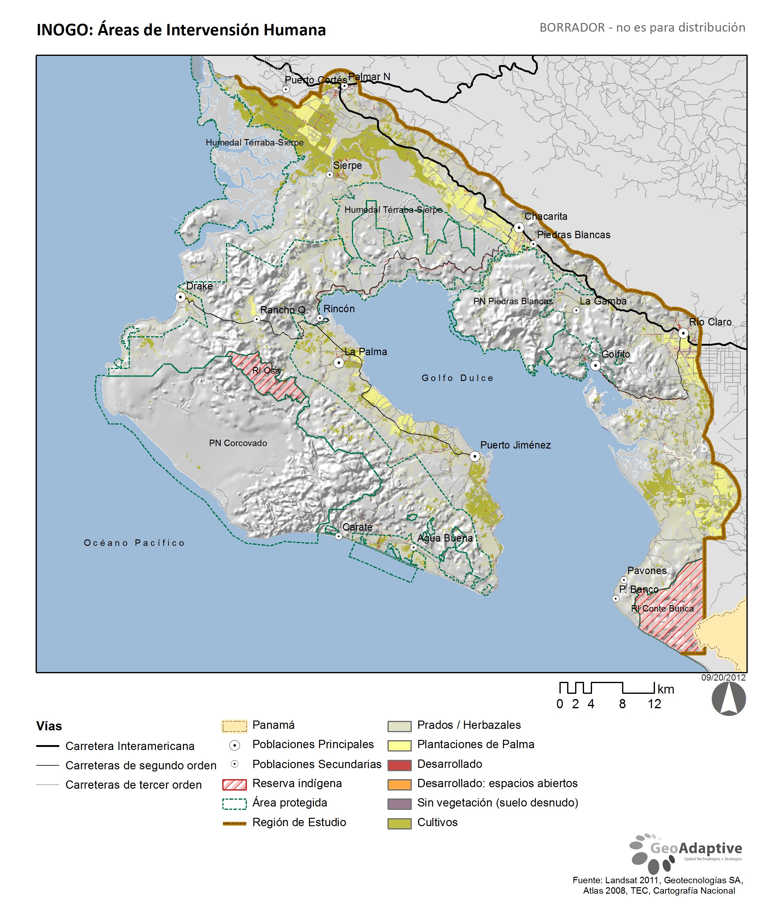
INOGO_Areas_de_Intervension_Humana.jpg (JPG/1,555.68 KB)
Stanford

© Stanford University

  • Terms of Use
  • Privacy Policy
Stanford Woods Institute for the Environment