Caminos de Liderazgo Census-based socio-economic analyses
A key long-term outcome of interest to local inhabitants in the Osa and Golfito region of Costa Rica is greater economic security (i.e., increased economic opportunity and income) as a means of improving quality of life. A baseline analysis of socioeconomic conditions using the 2011 census was conducted by INOGO in the primary areas in which we work. More information about the Costa Rican census and a description of that work (with links to reports) can be found here.
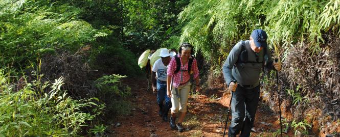
The Caminos de Liderazgo program is one intervention in the area that aims to increase socioeconomic development by increasing local job opportunities related to ecotourism. Initial efforts of the Caminos de Liderazgo Program aimed to strengthen ecotourism around 5 communities (Puerto Jimenez, Rancho Quemado, La Palma, El Progreso, and Drake) near Corcovado National Park as an engine for broader sustainable development in the region. To produce an analysis that is more sensitive to the area of intervention of the Caminos de Liderazgo program, a separate series of analyses was conducted on the same census dataset for just the UGMs1 falling within what has been labeled "the Caminos focal area."2
To more accurately define the "Caminos focal area", INOGO supported an organization called GeoPorter to interview members of 3 of the 5 communities about their boundaries as part of a training exercise to map local resources. These community-defined boundaries were considered together with existing natural and official administrative boundaries, as the "reach" of Cohort 13. These proposed boundaries were first vetted with representatives of the organizations providing technical and financial support to Caminos. Once agreed upon, the geo-spatial coordinates of the boundaries were then mapped by another INOGO consultant and all the UGMs falling within these boundaries were identified to include in the UGM-level analyses.
Three UGM-level reports were developed for this more focused geographic area containing differing levels of detail. The first includes statistics and graphs for each UGM falling within the Caminos focal area, organized according to district. The second report includes the same findings organized by district but without UGM- specific details. The most concise report, available in both Spanish and English, summarizes findings for just the Caminos initial focal area as a whole. This report can serve as a baseline for future analyses of the same socio-economic variables among households and inhabitants falling within the same geo-spatial boundaries.
- The lowest unit of analysis for the census is the UGM (unidad geoestadistica minima), defined by INEC according to geographic size/boundaries (different for urban versus rural areas).
- Importantly, these geo-spatial boundaries are not official but rather reflect the Program’s initial reach that, by design, is expanding over time.
- The majority of this area falls within the Puerto Jimenez District and, all of the Puerto Jimenez District falls within the Caminos initial focal area. A very small portion of this area, linked to the community of Rancho Quemado, falls within the adjoining Sierpe District.